Caltech Peak
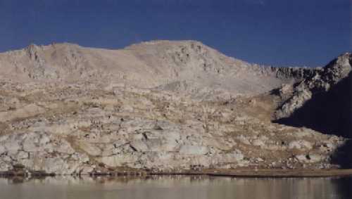
This picture of Caltech Peak is taken about two miles south (direct) of the Peak and West of the John Muir Trail at a unnamed lake (Elevation 11,400 feet). The hike to the summit (elevation 13,832 feet) from this location was non-technical and took about five hours round trip, plus two hours on the summit. Good place to camp to enjoy the mountain and surrounding scenery. See Map page for route and location of campsite. If the greenhouse gases cause the ice caps to melt, here is a computer generated water front view of Caltech Peak The view from the top of Caltech Peak is outstanding and is captured in a panoramic series of photographs taken in September, 1999. See the listing of Caltech student and faculty/staff who are known to have climbed Caltech Peak. Web links with information on Caltech Peak
|